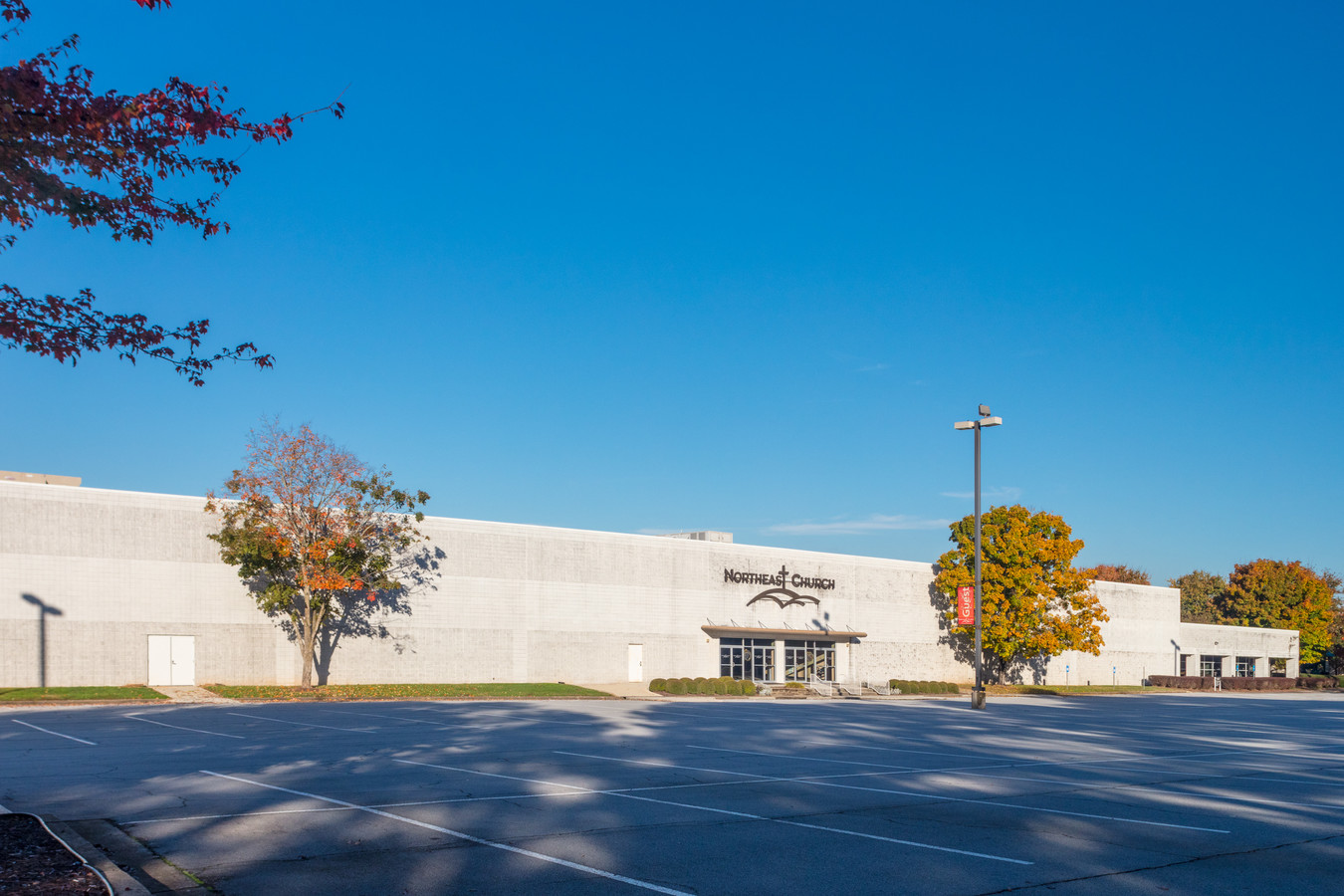
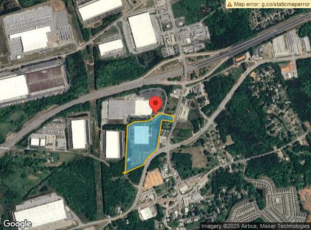
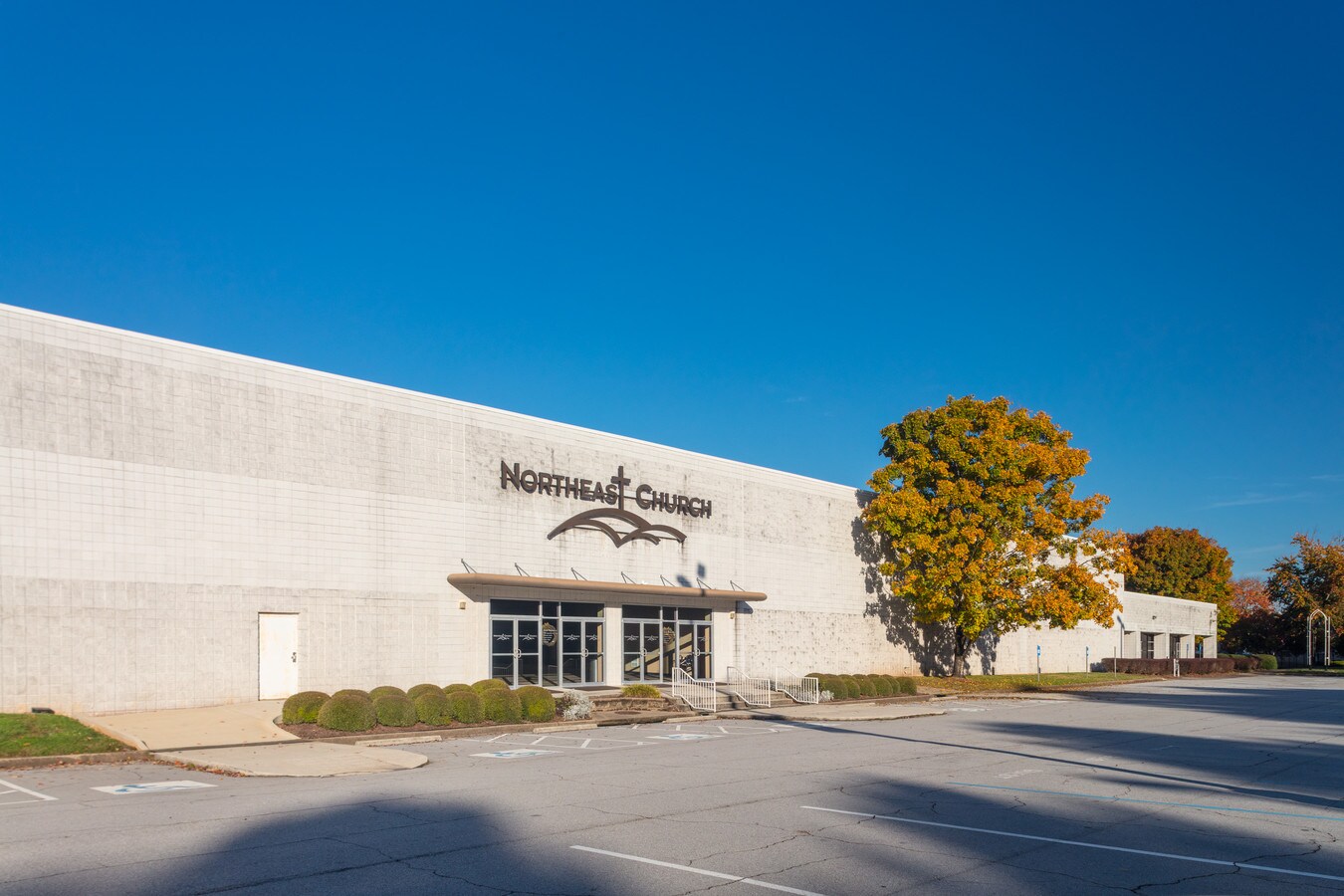
Property Record
2001 Cherry Dr, Braselton, GA 30517
NEARBY LISTINGS FOR SALE OR LEASE
Property Detail
2001 Cherry Dr
119-004J
21.60 ACRES PLAT BOOK 81 PAGE 90
Religious
Jackson
X
Georgia
13013C0050D
21.60 AC
2023
Jackson County
2023
Atlanta
010106
Jefferson, GA
146,571 SF
DEMOGRAPHICS near 2001 Cherry Dr
1 Mile
3 Mile
5 Mile
2024 Total Population
1,174
14,537
41,912
2029 Population
1,502
18,394
50,494
Pop Growth 2024-2029
+ 27.94%
+ 26.53%
+ 20.48%
Average Age
38
38
40
2024 Total Households
417
4,895
14,387
HH Growth 2024-2029
+ 26.38%
+ 25.19%
+ 19.44%
Median Household Inc
$71,699
$93,194
$96,705
Avg Household Size
2.80
3.00
2.90
2024 Avg HH Vehicles
2.00
2.00
2.00
Median Home Value
$317,129
$321,565
$343,174
Median Year Built
2004
2006
2005
Nearby Places
- Restaurants
- Banks
- Shops
- Fitness
- Groceries
SALE & LEASE HISTORY
LISTING DATE
SALE/LEASE

Jan 15, 2019
For Sale
Nearby Properties
Address
Land Use
TOTAL SIZE
Lot Size
Zoning
Address
Land Use
TOTAL SIZE
Lot Size
Zoning
979,317 SF
107.36 AC
001
Address
Land Use
TOTAL SIZE
Lot Size
Zoning
160,277 SF
53.40 AC
PUD
Address
Land Use
TOTAL SIZE
Lot Size
Zoning
613,440 SF
50 AC
003
Address
Land Use
TOTAL SIZE
Lot Size
Zoning
510,720 SF
48.46 AC
M1
Address
Land Use
TOTAL SIZE
Lot Size
Zoning
521,290 SF
23.60 AC
MD
Address
Land Use
TOTAL SIZE
Lot Size
Zoning
502,088 SF
36.80 AC
MD
Address
Land Use
TOTAL SIZE
Lot Size
Zoning
348,990 SF
86.93 AC
M
Address
Land Use
TOTAL SIZE
Lot Size
Zoning
422,920 SF
24.70 AC
MD
Address
Land Use
TOTAL SIZE
Lot Size
Zoning
462,000 SF
30.12 AC
M1
Address
Land Use
TOTAL SIZE
Lot Size
Zoning
446,439 SF
30.47 AC
003
Address
Land Use
TOTAL SIZE
Lot Size
Zoning
500,500 SF
53.92 AC
MI
Address
Land Use
TOTAL SIZE
Lot Size
Zoning
438,375 SF
32.69 AC
Address
Land Use
TOTAL SIZE
Lot Size
Zoning
805,954 SF
52.41 AC
003
Address
Land Use
TOTAL SIZE
Lot Size
Zoning
547,250 SF
47.51 AC
M1
Address
Land Use
TOTAL SIZE
Lot Size
Zoning
554,285 SF
70.18 AC
Address
Land Use
TOTAL SIZE
Lot Size
Zoning
222,000 SF
20.59 AC
003
Address
Land Use
TOTAL SIZE
Lot Size
Zoning
71.15 AC
001
Address
Land Use
TOTAL SIZE
Lot Size
Zoning
76,566 SF
10.30 AC
PUD
Address
Land Use
TOTAL SIZE
Lot Size
Zoning
42,848 SF
4.55 AC
G
Address
Land Use
TOTAL SIZE
Lot Size
Zoning
131,875 SF
18.93 AC
C
Address
Land Use
TOTAL SIZE
Lot Size
Zoning
76,792 SF
19.31 AC
003
Address
Land Use
TOTAL SIZE
Lot Size
Zoning
8,752 SF
11.40 AC
OI
Address
Land Use
TOTAL SIZE
Lot Size
Zoning
25,194 SF
6.36 AC
C2-GENERAL
Address
Land Use
TOTAL SIZE
Lot Size
Zoning
378.65 AC
004
Address
Land Use
TOTAL SIZE
Lot Size
Zoning
110,034 SF
11.57 AC
001
Address
Land Use
TOTAL SIZE
Lot Size
Zoning
51,710 SF
2.20 AC
GC
Address
Land Use
TOTAL SIZE
Lot Size
Zoning
224.76 AC
004
Address
Land Use
TOTAL SIZE
Lot Size
Zoning
60,128 SF
2.48 AC
001
Address
Land Use
TOTAL SIZE
Lot Size
Zoning
65,501 SF
2.20 AC
GC
The World's #1 Commercial Real Estate Marketplace
Connect with us
© 2025 CoStar Group
The information above has been obtained from sources believed reliable. While we do not doubt its accuracy we have not verified it and make no guarantee, warranty or representation about it. It is your responsibility to independently confirm its accuracy and completeness. Any projections, opinions, assumptions, or estimates used are for example only and do not represent the current or future performance of the property. The value of this transaction to you depends on tax and other factors which should be evaluated by your tax, financial, and legal advisors. You and your advisors should conduct a careful, independent investigation of the property to determine to your satisfaction the suitability of the property for your needs.